What can Mappia do?
LegendHtml getid LoadCsv Slider RunOnceLayerVisible changeLayers Label Highcharts 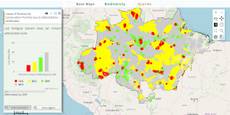
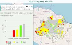
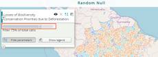
AMAZONES - Biodiversity
Show deforestation threat in regions of biodiversity relevance.
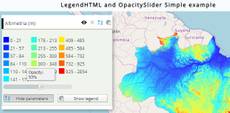
Legendhtml getId LoadCsv Slider changeLayers Label Highcharts 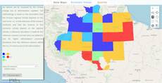
AMAZONES - Hydrologic services
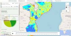
Process and query map values.
Slider Label Textfield isnumeric priority legendTitle title 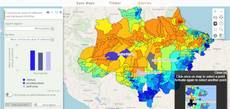
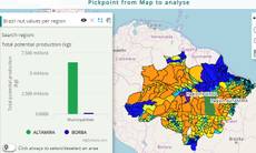
AMAZONES - Timber product
Display using a graph timber volumes and rents per region.
Slider Label Textfield isNumeric visibleLayers priority LegendTitle Title 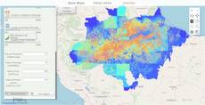
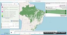
Economic valuation
Real-time display of ecosystem services values given a combination of inputs and weights.
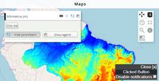
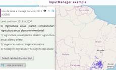
Timeline setQueryGlobalProperties paramsButtonConfig InputManager visibility 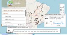
Fip Cerrado project
Fire propagation modeling in the cerrado biome.
scale startopened hidestylechooser enablequeries visiblelayers 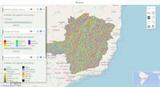
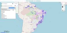
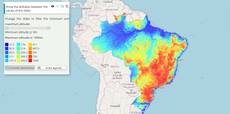
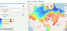
Hydrologic resources influenced by land use change
Display multiple maps together.
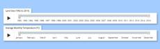
Available interaction tools


Raw Maps
Soon
Tutorials
- Steps to easily publish yourself maps: Checkout the tutorial.
- How customize the maps by visual edition: Soon.
- How customize the maps by code edition: Soon.