Rio Doce basin - Priority areas for restoration
Part of the project Priority areas for environmental restoration of the Rio Doce basin.
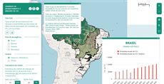
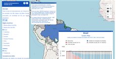
The map from Identification of priority areas for environmental restoration of the Rio Doce basin gathers the project’s results for the basin: priority areas for water supply sources (mananciais), an environmental and a social vulnerability index, the land’s suitability (“vocação”) for natural regeneration, for planting without an economic purpose and for planting with one, and the matching priority maps for each of these three ways of restoring vegetation. Base maps give the basin limit, its municipalities and its drainage network. Turn layers on and off, read the value under the cursor, and click the map to identify what lies there. Query 184 is under 1 KB: it shows how far plain layer definitions and the map address go before any widget or function is needed.
How it is built
- Two groups. “Mapas base” and “Resultados” are each written as
title,colorandelements. See the layer and group model. - Layers by name only. Each layer is a published map (
CSR:...); its title, legend and styles come from the map server, not from the query. - Order and start state.
priority(100 down to 45) fixes the order in the panel, andvisibility: trueturns on the basin limit and the environmental vulnerability index at start. - Tools from the address.
tools=...getfeature,hovershowlegendadds the identify button and the legend value under the pointer, andoptions=scale,startopened,capabilitiesadds a scale bar, opens the layer panel and loads only the maps the query names. See map toolbar tools and page options.
Try this
- Turn on the three “vocação” layers one after the other and compare them with the priority maps.
- Hover over the social vulnerability index to read its value under the pointer.